

New images of Mars satellite by Hope probe
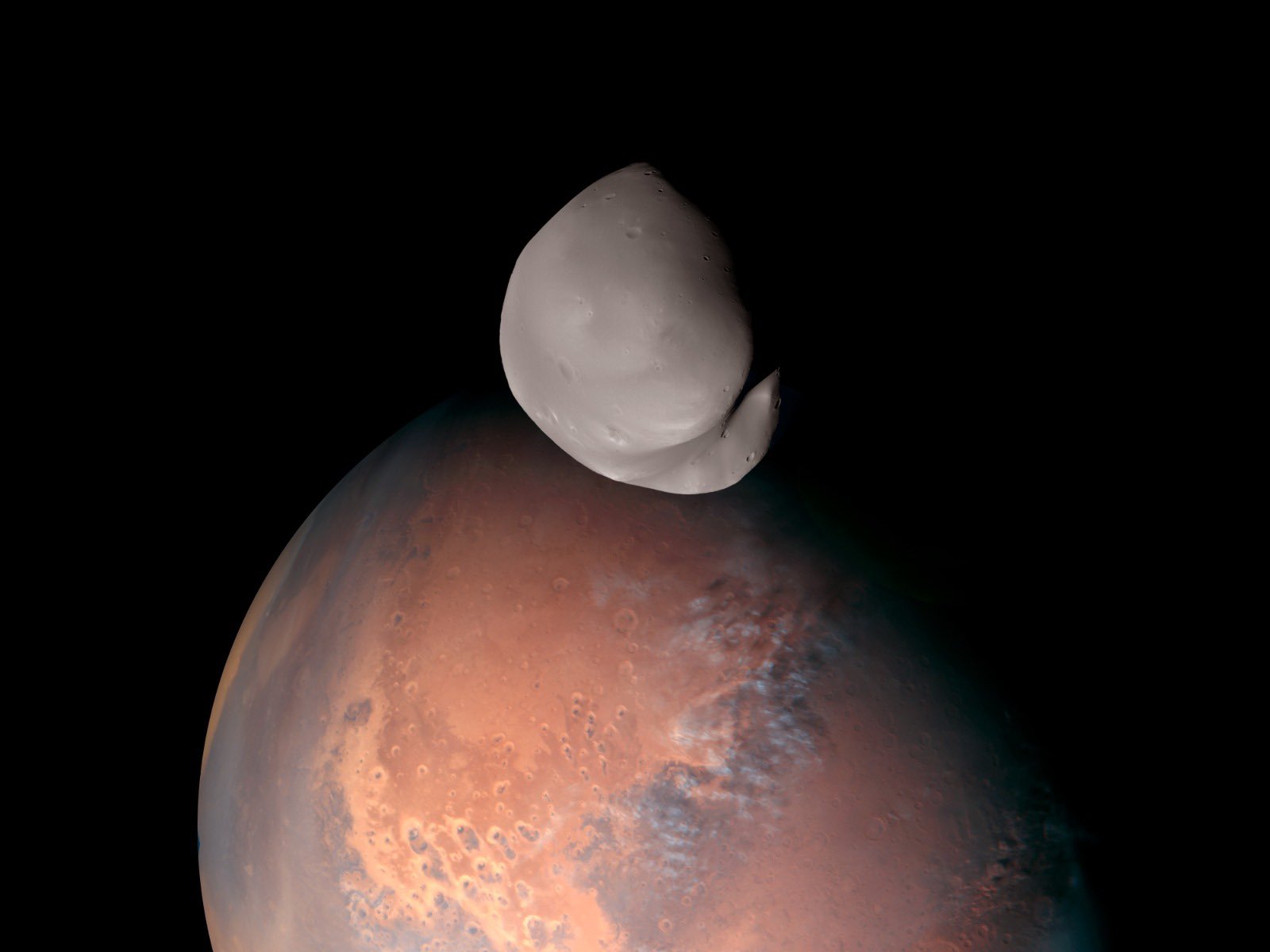
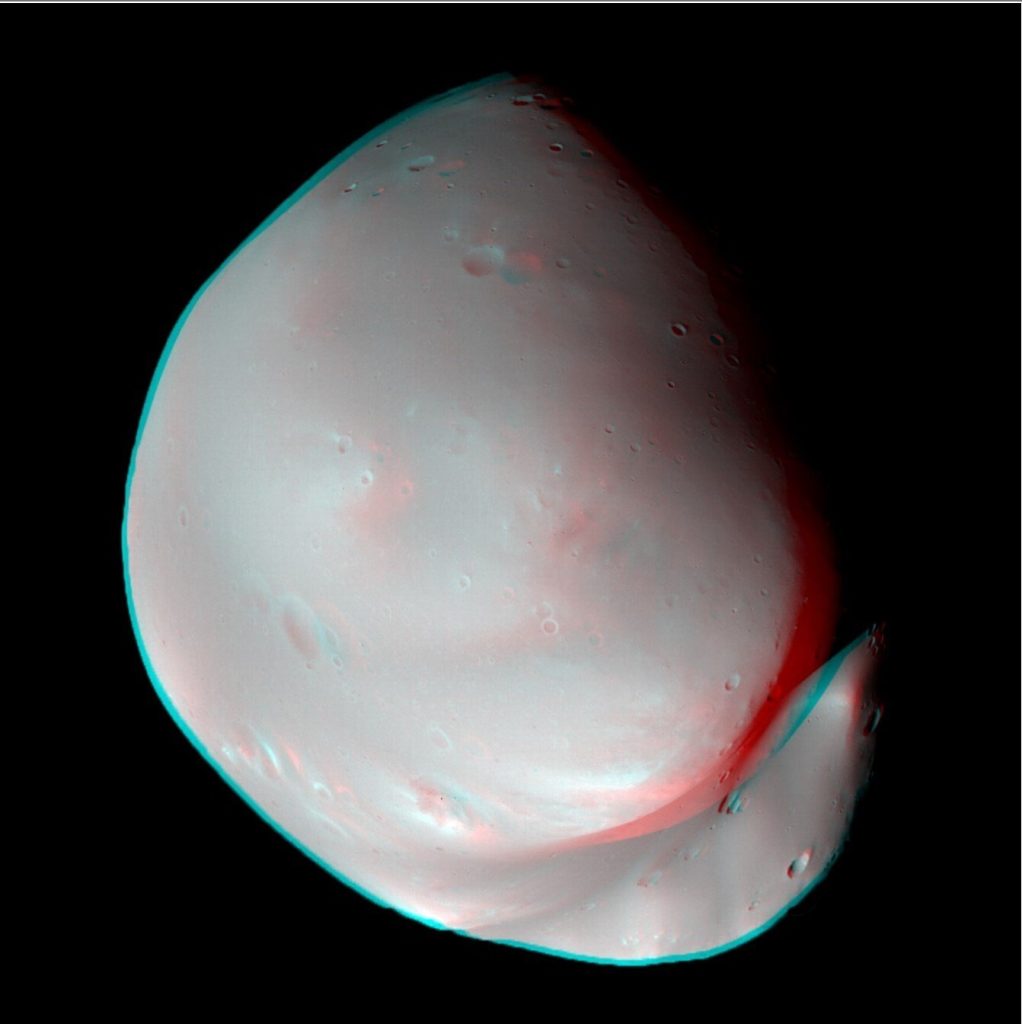
The Hope probe has sent back unique images of Mars’ satellite, Deimos, to Earth.
The spacecraft was built by more than 200 Emirati engineers, scientists and researchers. The Hope probe was built in collaboration with three US universities, including the University of Colorado at Boulder, the University of California at Berkeley and Arizona State University.
The spacecraft arrived in orbit of the Red Planet in February 2021 and has since been sending important data on Mars’ upper atmosphere and space weather, including studies of dust storms and auroras.
This week’s images of Deimos, taken at about 100 km altitude, refute the theory that the satellites of Mars – Phobos and Deimos – are asteroids trapped in its orbit. On the contrary, they may be of planetary origin. It is now up to scientists to figure out exactly how they ended up in their current orbits.
Researchers have used more than 3,000 images captured by the orbiting HOPE probe to create a unique map of Mars (it was published in April as the result of work by a team of scientists from New York University Abu Dhabi and the United Arab Emirates Space Science Centre).
The new map could help scientists answer a number of pressing questions about Mars, including how the planet became an arid desert even though it once had abundant liquid water.
In May 2022, the Hope space probe detected a new type of polar aurora on Mars – a sinuous, discrete aurora. It consists of long worm-like streaks of excited electron emission in the upper atmosphere. The lines extend thousands of kilometres from the day side to the night side of Mars.
In June 2021, the spacecraft sent photos of a discrete polar aurora in the atmosphere on the night side of Mars back to Earth. The images were taken by the spacecraft’s ultraviolet spectrometer (EMUS) during a solar storm.
In March 2022, the probe sent images of the dust storm on the Red Planet to Earth. Scientists were able to observe how the storm developed and spread to mountains and craters. The spacecraft also sent Earth pictures of Phobos, Mars’ largest satellite and one of the smallest natural satellites in the solar system.
In total, the interplanetary station will send to Earth more than 1 terabyte of data, which will be distributed among 200 academic and scientific institutions around the world. The spacecraft, with the UAE national flag on its hull, has covered a distance of 493 million km.
Source: The National
Follow our Telegram Chanel